MORE FOG WEDNESDAY NIGHT, MORE SUNSHINE THURSDAY, THEN SHOWER/STORM CHANCES RETURN FOR SOME FRIDAY
It was a foggy start to Wednesday in the Northland. Thanks to the moisture from our most recent storm system to pass through earlier in the week, combined with a high-pressure system to keep winds calm, and the fog got dense in plenty of locations. It has lingered on and near Lake Superior throughout the day, but for most of us we have been enjoying a sunny and warm early fall day with highs in the 70s. It has remained in the 60s near the lake with any wind coming from the east.


The high-pressure system will continue to be our main influence for the Northland’s weather conditions over the next 24 hours, which means more of the same. We will see skies remain clear to mostly clear of clouds above us Wednesday night. However, very light winds and lows in the upper 40s and 50s will lead to more fog across the region, and it will be dense at times. A Dense Fog Advisory is in effect for most of the region, so plan for this when heading out for the Thursday morning commute. We will see more sunshine and light winds from the east/southeast Thursday. This will mean more 70s for highs, with 60s likely next to Lake Superior.


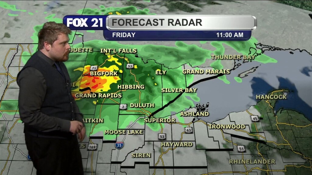
The next storm system to push into the western Great Lakes region will begin to bring increased cloud cover Thursday night. We will be watching the showers and thunderstorms that form along the United States/Canada border in the Dakotas Thursday night, as they could be able to hold together long enough to bring heavy rain and gusty winds to the Rainy River Basin region Friday morning. Isolated showers will remain possible over the northern half of the Northland Friday with temperatures remaining in the 60s and 70s for highs.


A high-pressure system will keep the Northland dry for the weekend, with temperatures remaining warm for mid-September with plenty of locations seeing the 70s for highs. The first half of next week is looking to remain warm, but also unsettled as a couple low-pressure systems will bring chances for showers and thunderstorms through the region. As of now, Monday and Wednesday look to have the best chances, but neither day look to be washouts.
Chief Meteorologist Rusty Mehlberg


