Sunday Evening Northland Forecast: 12/7/2025
A Snowy Week
I’m pretty sure there’s a 100% chance we are going to have a very White Christmas, this year. We already have a foot of snow on the ground, and there’s more coming, each of the next 3 days. Plus, our high and low temps have been below average for about 2 weeks, so the snow certainly isn’t melting any time soon. And the next 2 weeks look even colder, than the last 2 weeks.
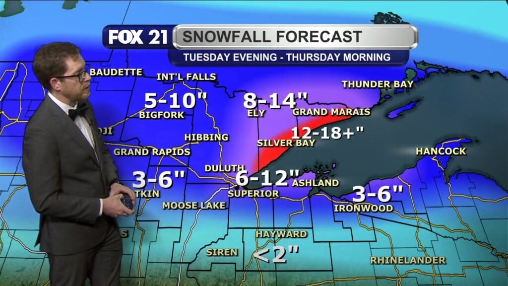
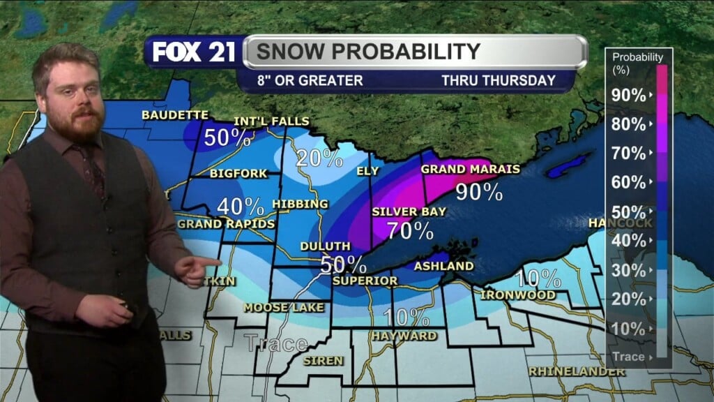
From Monday morning to Tuesday morning, there is a Winter Weather Advisory for Lake and Cook Counties (including Two Harbors) for 2″-5″ of snow. There is also a Winter Storm Watch for NE North Dakota, and NW Minnesota, for all of Tuesday. Snow amounts will be in the 4″-6″ range on Tuesday and Tuesday night. Some areas could see much more, and the Watch area will likely be expanded to the Twin Ports. Stay tuned for more information and updates on that storm.
And, that won’t be the only snowmaker. We will have a series of low pressure systems (Alberta Clippers) sailing over the Northland this week. One will fly through about every day and a half. I wouldn’t be surprised at all, if we add another 6-8″ of snow to what we already have on the ground, by the end of this week. Probably an additional foot, in some areas. Our normal high for today is 27 degrees. We had a high of 9. And, this is going to be another colder than average week, with highs, starting Monday, of 17, 23, 15, 13 and 6. So, our well-below average temps continue. We will be below zero degrees each night, the second half of this week, too.
So, get ready, cold and snowy conditions are coming right here. Be prepared, and have a great week!
FOX 21 Meteorologist Karl Spring


