Friday Evening Northland Forecast: 1/16/2026
A Cold and Windy Weekend
Historically, January 17th is the coldest day of the year in Minnesota. On average. Over the last 125 years or so. That’s what climate records tell us. And, right on time, some of the coldest air of the year (so far), has arrived. A low pressure system that dove through the area from Canada, did two things. It produced about 5″ of snow in the Twin Ports, since Midnight. And, it is also pulling a massive area of cold, Canadian high pressure behind it. That is going to produce a cold and windy weekend for us. By tomorrow night, we’ll be down to -8 for an overnight low, and the low on Sunday night will plunge to -12. The high temp on Monday will be a measly -3. The windchills during that period will easily be in the -30 to -40 range. You know the drill. Dress in layers. And, wear a hat.
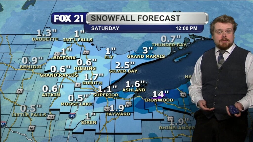
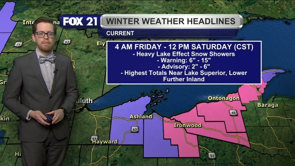
The jetstream is stuck in a NW to SE route for the forseeable future, so this cold is going to stick around for at least the next week. Any snow amounts we do get, will be minor. A couple inches here or there. The South Shore, and the U.P. of Michigan will get much heavier amounts of snow, as that cold air will race across a wide open Lake Superior, and the lake effect snow machine will be ON for business. If we get 2″ of snow this weekend, parts of the U.P. will get 14″. I’m jealous.
Our normal high for this time of year is in the low 20s. We won’t see any temps that warm for at least a week. By next Friday, our high is only projected to be about 16 degrees. We are below normal snow amounts in Duluth, but our temps sure feel winter-like.
Still crossing my fingers for a BIG snowstorm…..here! Have a great weekend!
FOX 21 Meteorologist Karl Spring