COLD & MOSTLY DRY WEEK WITH PERSISTENT LAKE EFFECT SNOW FOR THE U.P.


Happy Tuesday, Northland! With the frigid cold we have been seeing here in the Northland, yesterday was certainly an improvement. Highs were able to get into the single digits and low teens above zero, which still isn’t warm but it did feel better. This was brought on by a clipper that also brought along a band of light snow and a cold front. The cold front will bring breezy winds out of the north and will also keep highs today similar to yesterday despite a more “comfortable” morning, with most of us in the single digits. Through much of this week, we will be staying quite consistently chilly.
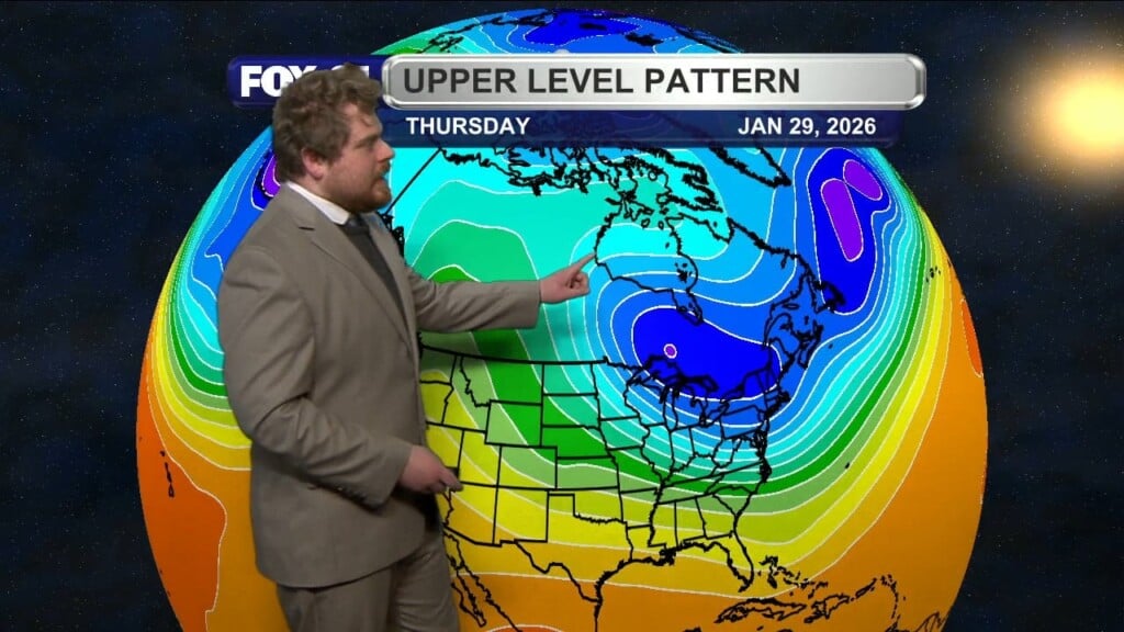
Most of the snow has moved out and we will overall stay quite dry this week thanks a couple of anticyclones that will move down from Canada. Some light snow will still be possible at times during the mid-week though very minimal. For the Upper Peninsula, it will be a different story as lake effect snow is expected to bring multiple inches through the week, primarily for Ontonagon County. Models do vary but at minimum we can see spots get over 3” through Wednesday. Turning to the jet stream, despite the lobe of low geopotential heights over the Great Lakes that is associated with colder temperatures, we will finally see a ridge propagate eastwards. This will bring seasonal to even mild conditions this weekend to kickoff February, with highs getting into the twenties by Saturday and Sunday. This will also come along with another chance for light snow showers. With that, I hope everyone has a fantastic Tuesday!
Morning Meteorologist James McAllister