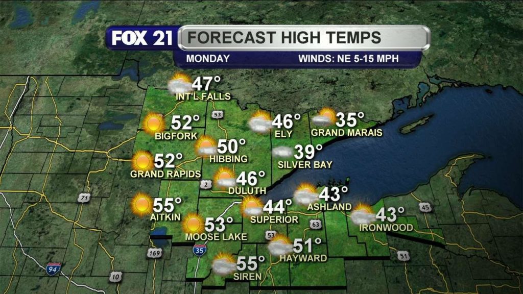
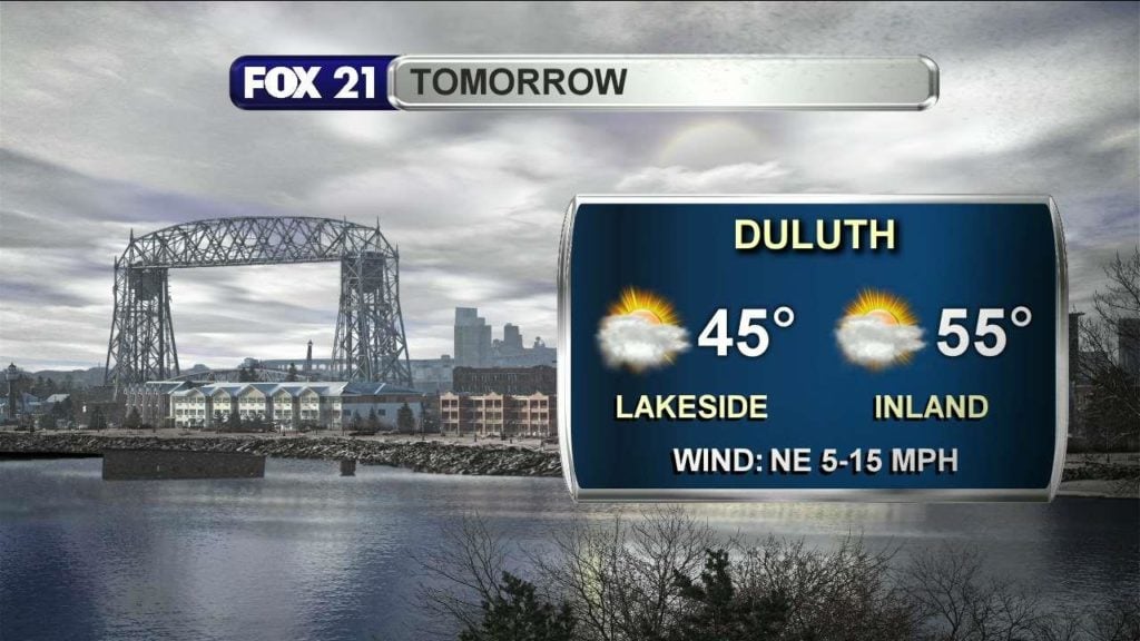
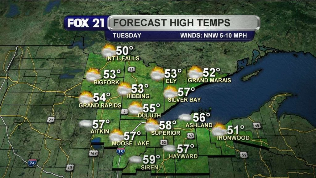
Monday, April 17, 2017, Morning Forecast
Mostly cloudy this morning, hoping for sun later today, cooler near the lake.
Mostly cloudy this morning, hoping for sun later today, cooler near the lake.
Categories: Weather Video
Categories: Weather Video Tags: brittney merlot, Easter showers, spring weather, weather
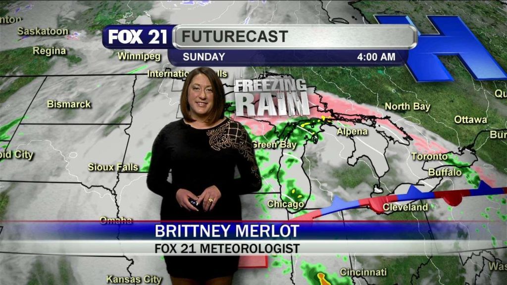
Categories: Weather Video Tags: brittney merlot, heavy rain, Northland Weather, rain, Showers, spring rain, spring storms, storms, weather
Categories: Weather Video Tags: brittney merlot, duluth weather, Easter forecast, Easter weather, northland, rain, Showers, storms, weather
Categories: Weather Video Tags: brittney merlot, duluth, moisture, Northland Weather, rainy weekend, Showers, storms, superior, Wildfire
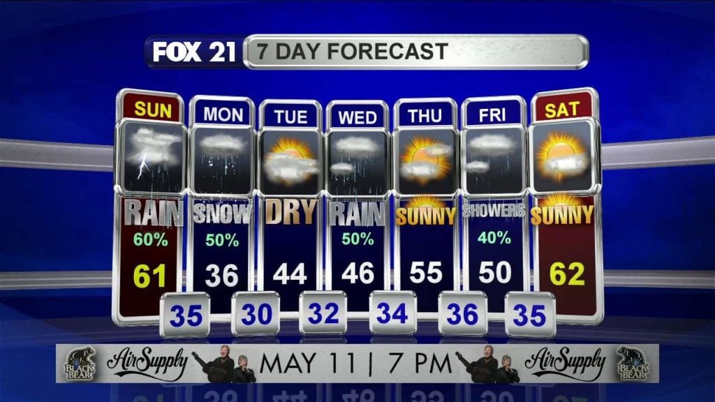
Fair and quiet today, stormy tonight, dynamic weather ahead through the next few days.
Categories: Weather Video
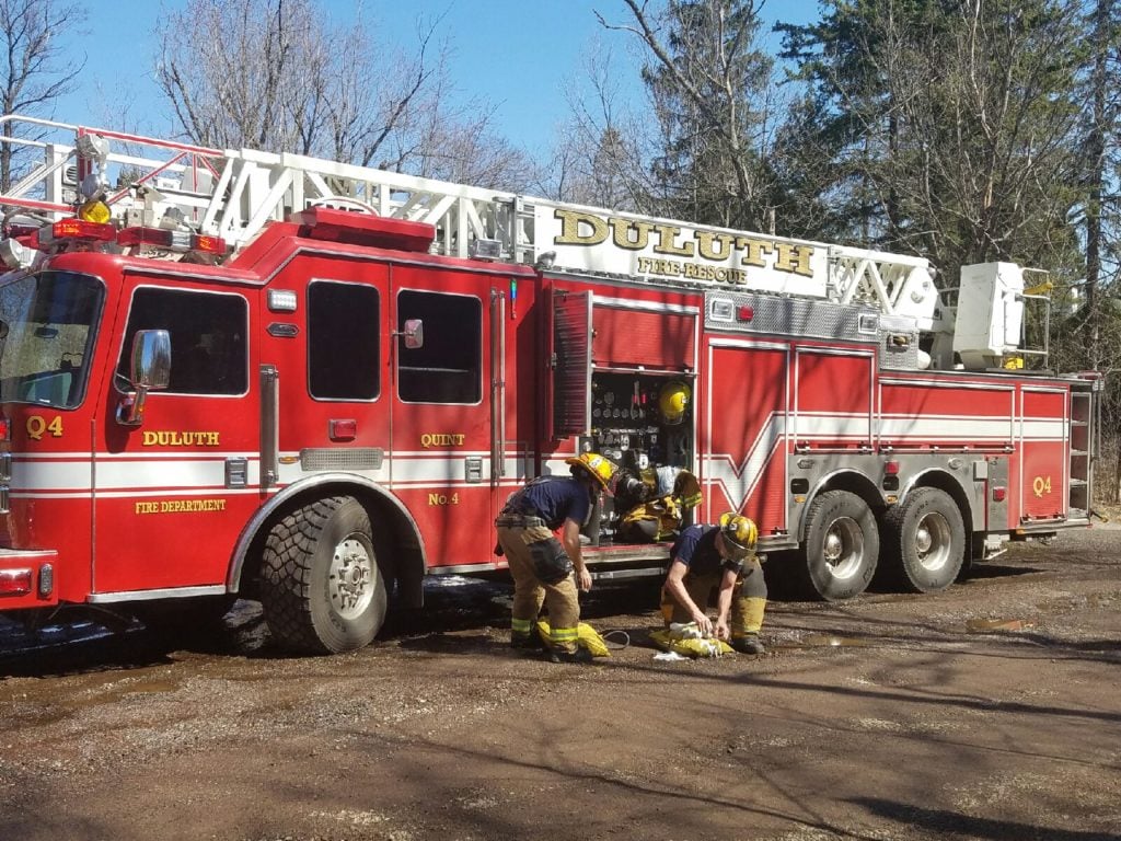
DULUTH, Minn. – A wildfire fire broke out early this morning just before 11 a.m. near the Hartley Nature Center and Glen Avon Overlook near the rock face. All fire units were called to a report of four to five separate areas burning with smoke filling the air. A Woodland resident who was out on her daily walk noticed the…
Fog to start the day, partly cloudy and pleasant through the rest of today, highs in the 50s and 60s.
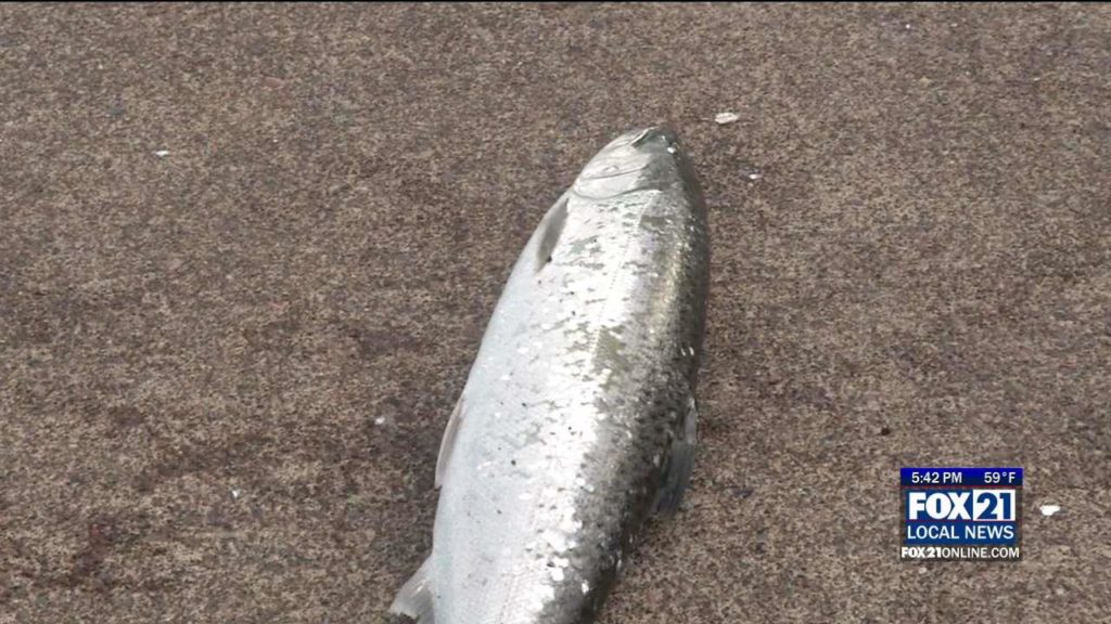
DULUTH, Minn. – Each Spring anglers take the shores of Lake Superior in hopes of a tasty salmon biting their line. Right now the Coho Salmon are running and chasing their primary food source, the smelt. Fishing is good along the south pier of the Canal in Duluth where many anglers try their luck in hopes to catch the prize…
Categories: Weather Video
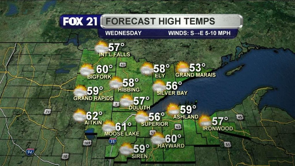
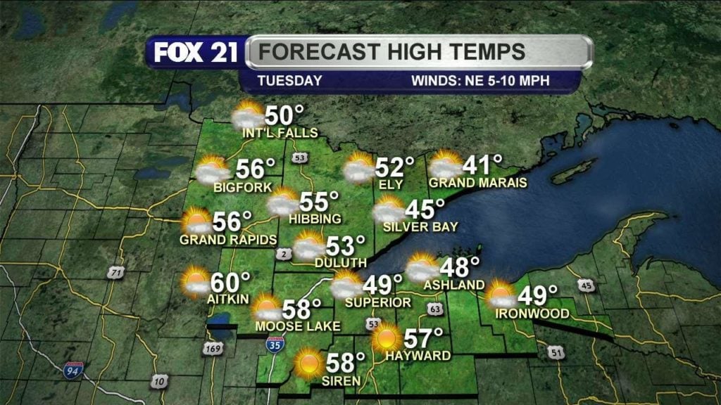
Partly cloudy today, with light southeast winds, and temperatures even warmer than yesterday.
Categories: Weather Video
School Closings and Delays for Tuesday, April 11, 2017: 2-Hour Delay: Watersmeet Schools Categories: School Closings Tags: school closing
Lingering clouds this morning, more sunshine later on, lake breeze keeps shoreline cool.
Categories: Weather Video
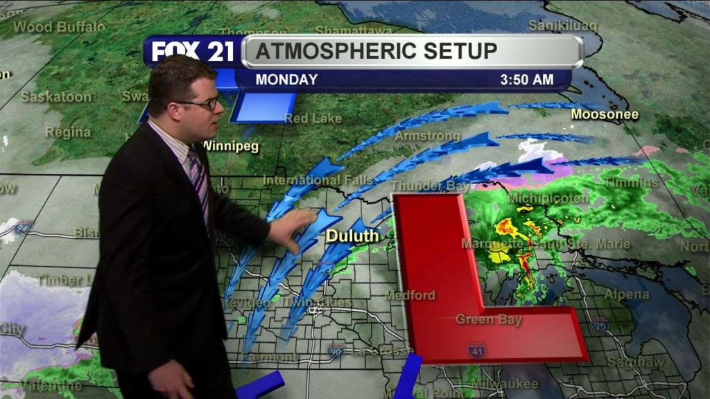
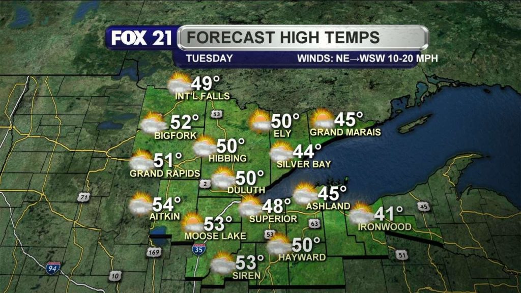
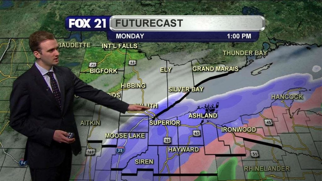
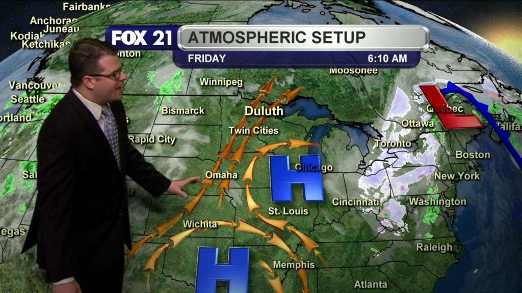
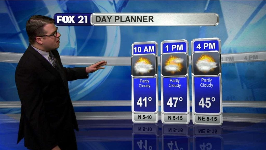
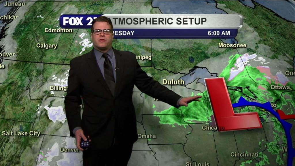
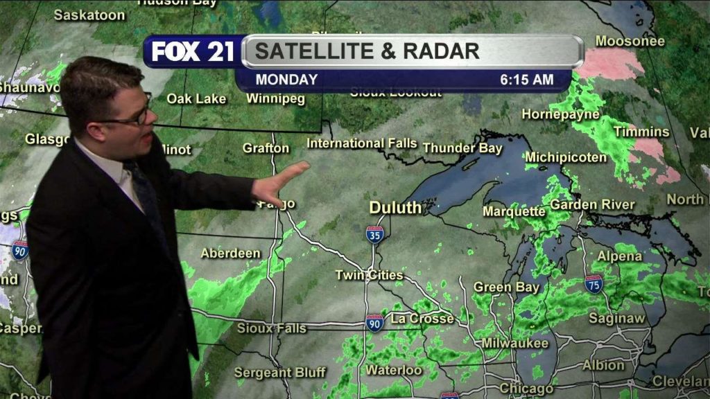
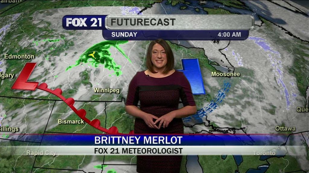
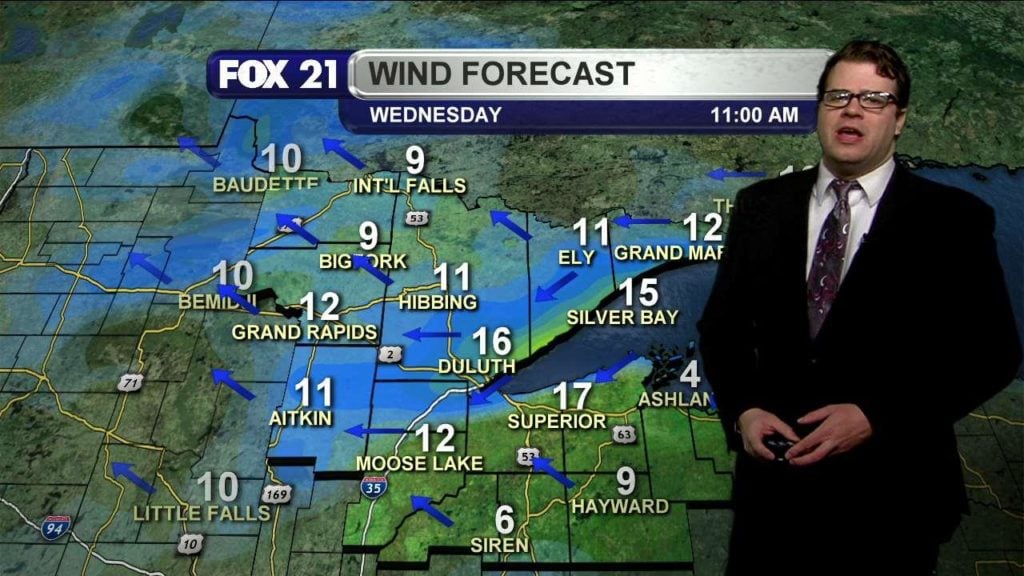
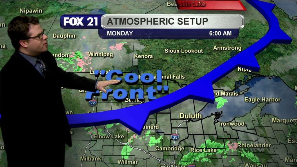
Today will be much cooler, windier, and possibly wetter than the weather we’ve seen in the past week or so. Let’s make sense of it here.
Categories: Weather Video
Categories: Weather Video Tags: above average temperatures, brittney merlot, duluth weather, northland, sun, superior weather, warm, warm front, weather
Categories: Weather Video Tags: brittney merlot, duluth, jupiter, northland, partly cloudy, superior, tonight’s weather, weather
DULUTH, Minn. – The City of Duluth is planning to detour Lakewalk Trail users due to necessary utility work from Endion Station to the Fitger’s Complex. Tuesday April 11 through Wednesday April 12 between the hours of 8 a.m. and 4 p.m. crews will be working on the underground drainage system. Users will be detoured up into Lake Place Park…
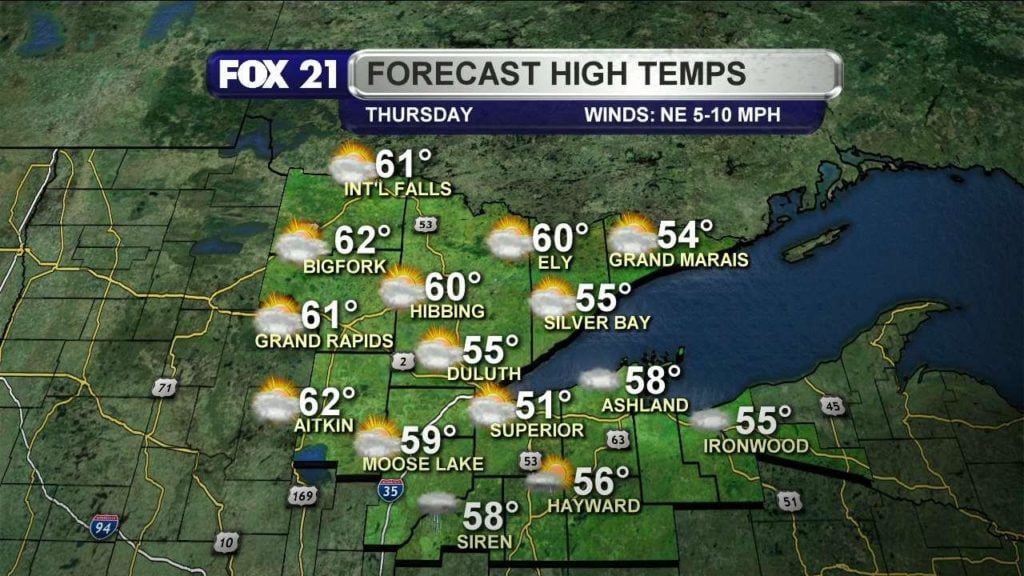
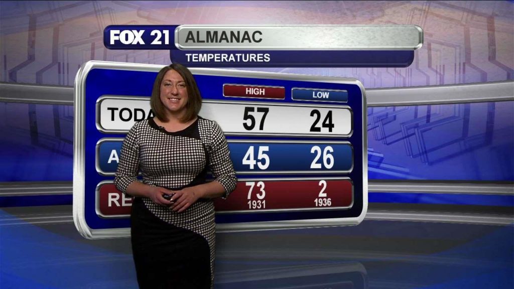
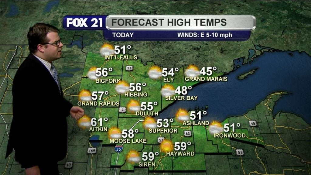
Magnificent weather on the way today, mostly sunny with highs in the upper 50s.
Categories: Weather Video

SUPERIOR, Wisc. – With above average temps across the Northland, golfers are already getting their swings ready. Nemadji Golf Course in Superior was packed this afternoon. Right now only the driving range and putting surfaces are open, but staff there says they will open the west course this Friday. Maintenance and grounds crew have been working nonstop the past few…
Categories: Weather Video
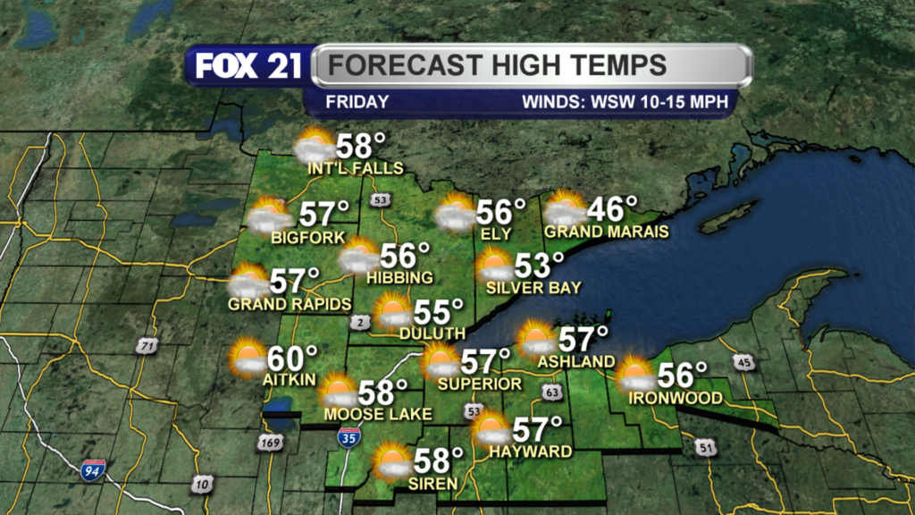
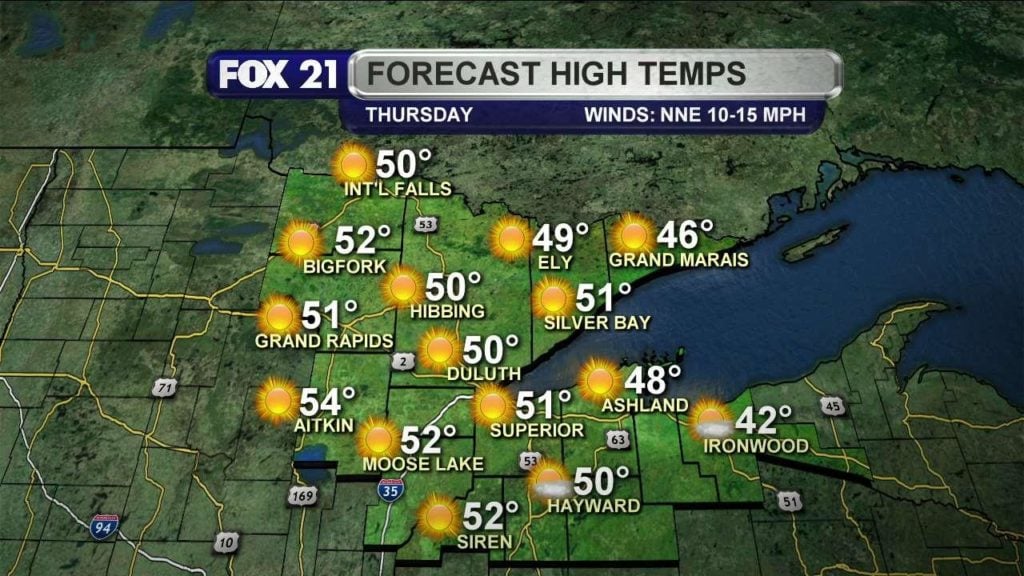
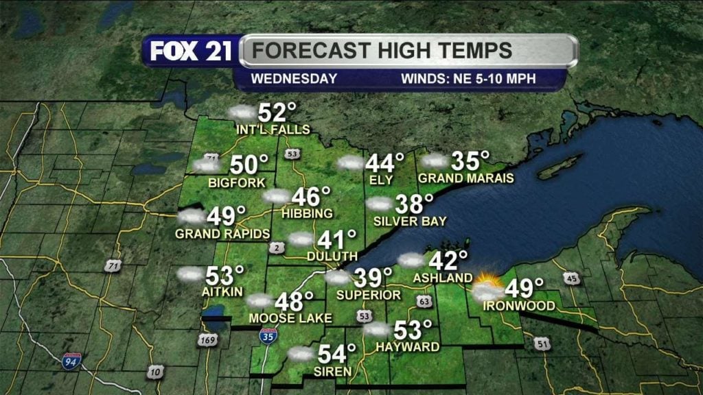
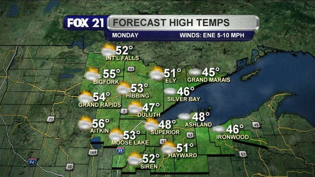
Partly/mostly cloudy today, with high temperatures in the 40s and 50s. North wind today as well.
Categories: Weather Video
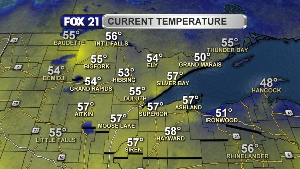
A little fog this morning, a few extra clouds today, steady north wind, and mild temps in the 50s later this afternoon.
Categories: Weather Video
Happy first week of April! A foggy, soggy start to the day today, with more mild temperatures by this afternoon; a bit of a lake breeze as well, but overall a cloudy and mild day.
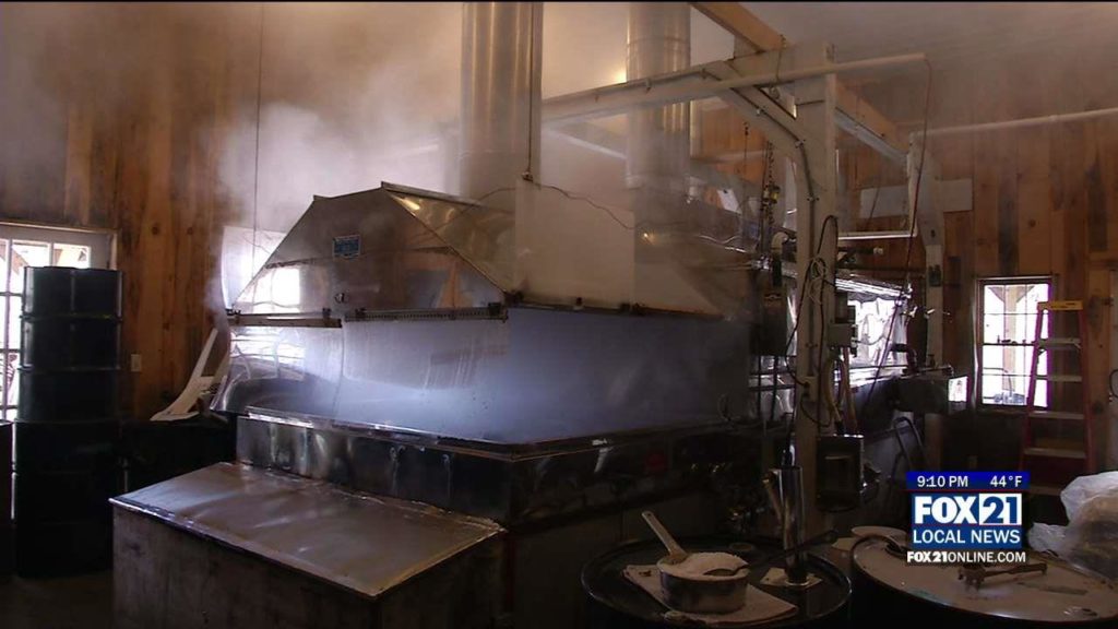
Maple Syrup Producing on the North Shore
Categories: Weather Video
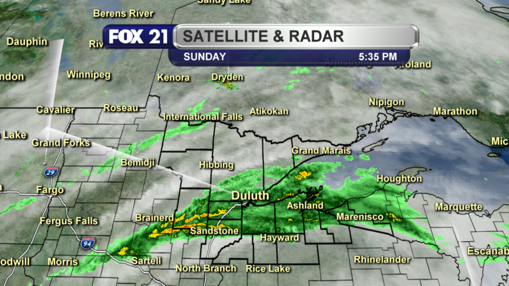
Sunday April 2, 2017, Morning Forecast
Saturday April 1, 2017 Evening Forecast
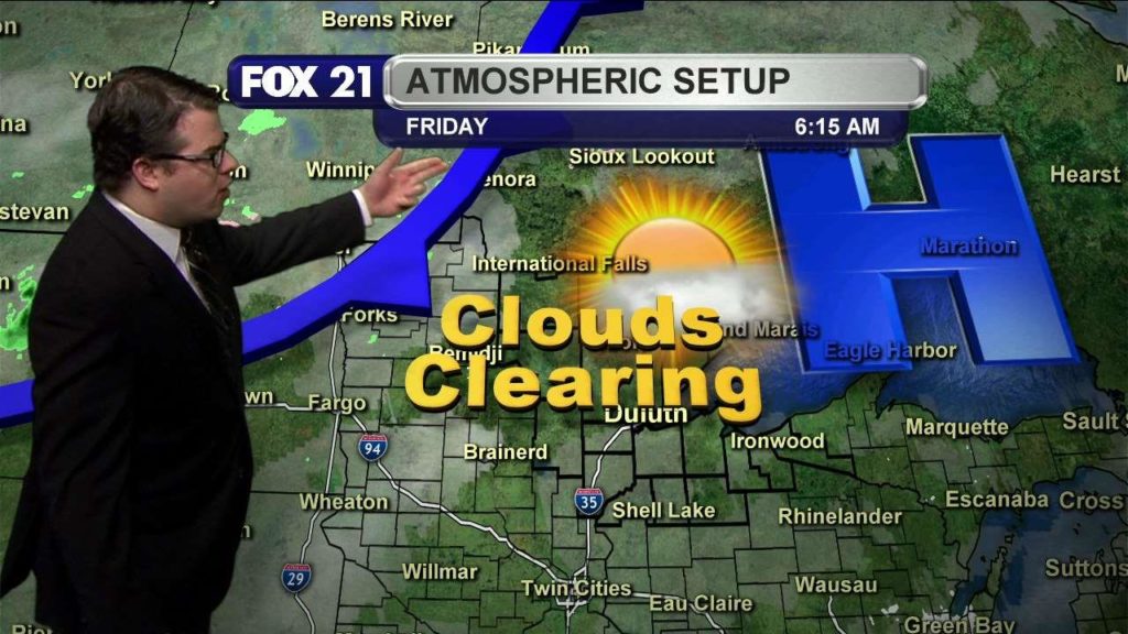
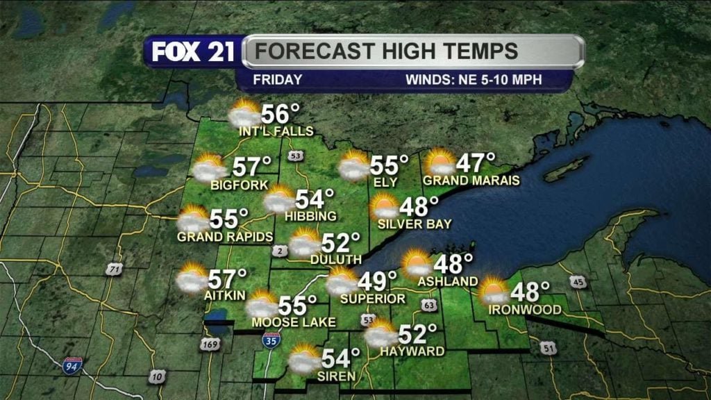
Fri Weather
Cool start to the day, with mostly sunny skies expected today; highs this afternoon reaching the 50s!
Categories: Weather Video
Another day of “cooler along the lake” with a steady wind out of the east and mostly cloudy skies.
Categories: Weather Video
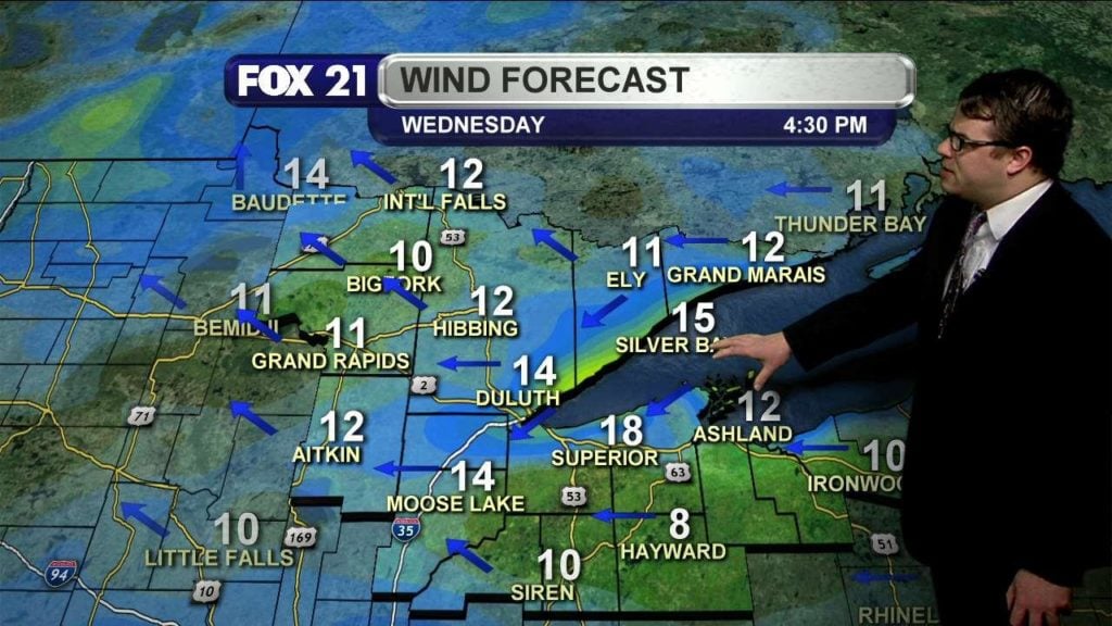
Strong east winds mean “cooler along the lake” will ring very true today.
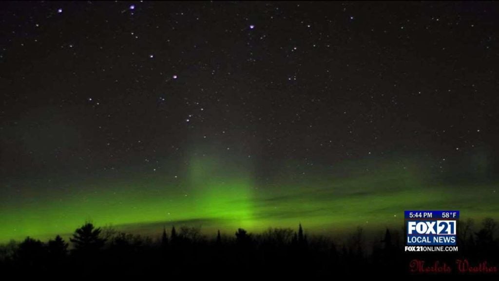
DULUTH, Minn. — Last night was a big night for the northern lights, and for those who love taking photos of them! The aurora borealis was visible even in the early evening last night, around 9:00pm, according to reports. Aurora hunters in the Northland say it was brightest past midnight last night, between 1:00 and 3:00am. These photos are from…
Categories: Weather Video
Mostly sunny today, with a quick warm up through the morning to the 50s by afternoon. A light lake breeze for the North Shore will develop as well.
Categories: Weather Video
Despite freezing temperatures this morning, and the threat for some freezing fog or freezing drizzle, we are expecting much warmer temperatures by afternoon.
Categories: Weather Video
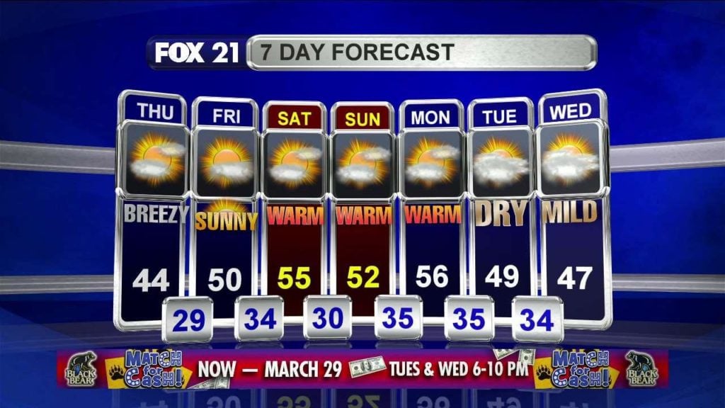
Sat Forecast


