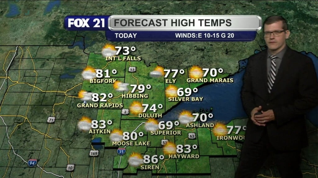
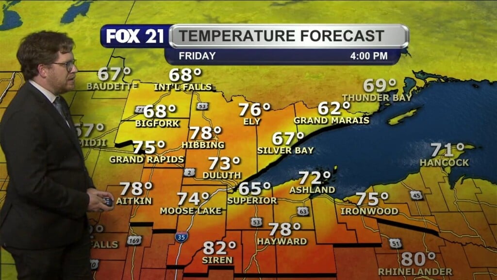
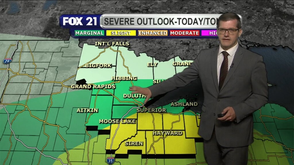
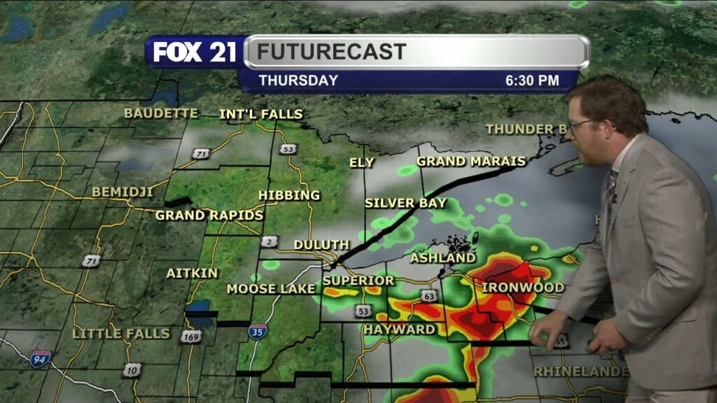
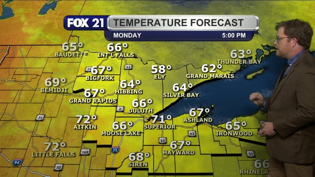
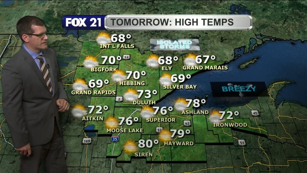
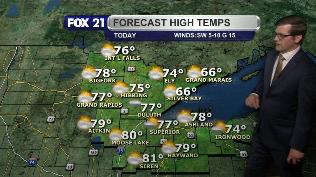
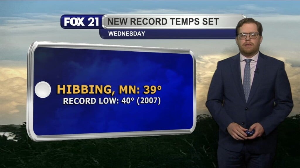
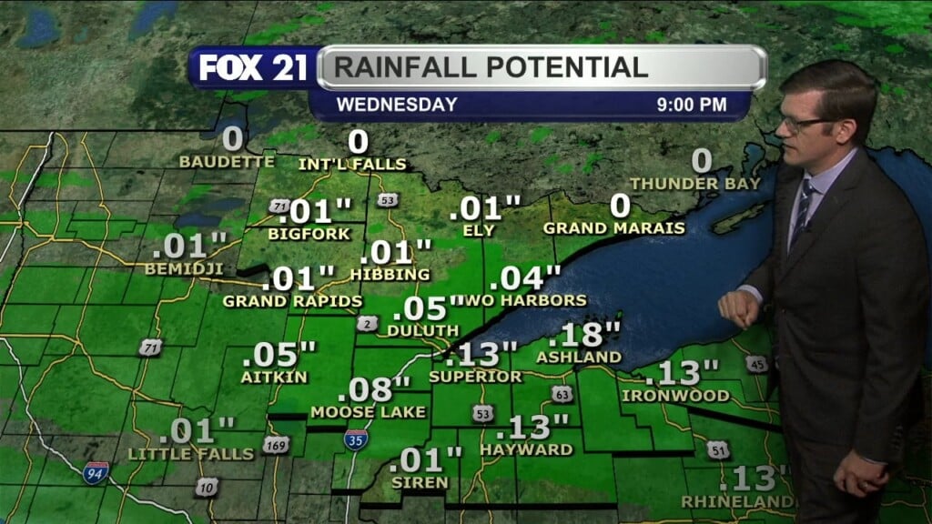
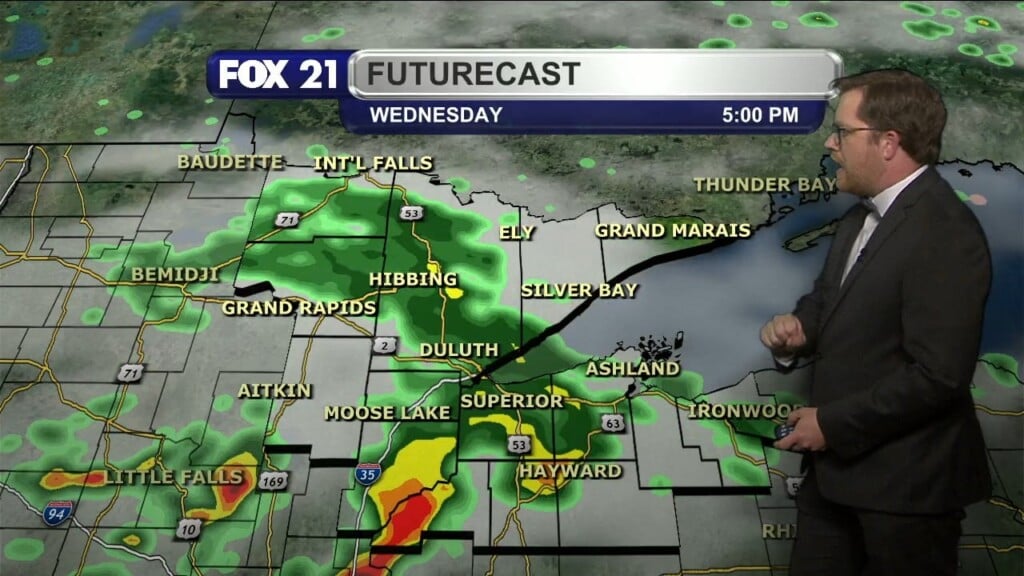
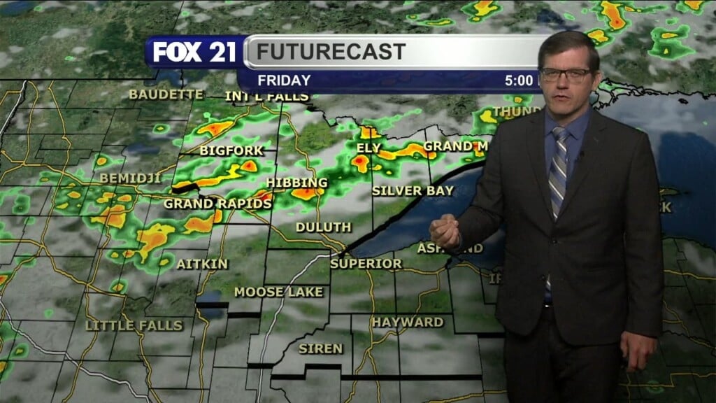
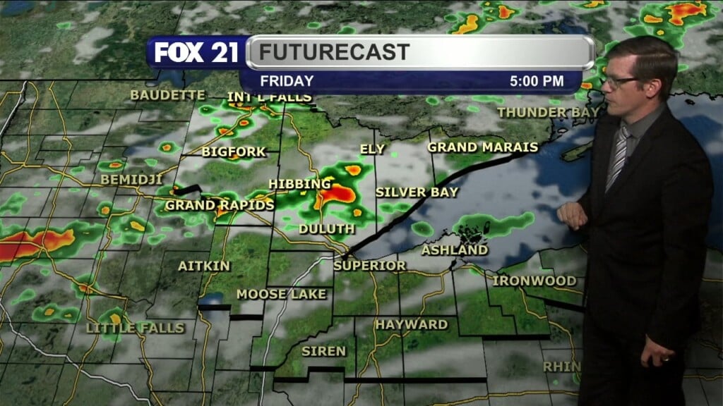
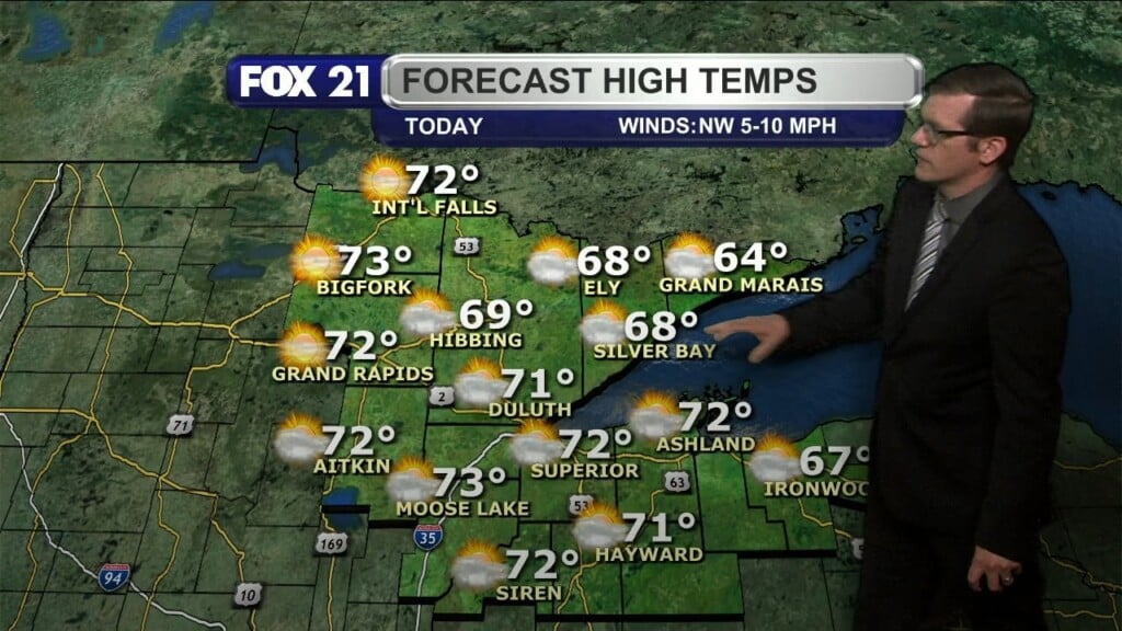
Friday, August 4, 2023 Evening Forecast
Categories: Weather Blog, Weather Video
Categories: Weather Blog, Weather Video
Categories: Weather Blog, Weather Video
Categories: Weather Blog, Weather Video
Categories: Weather Blog, Weather Video
Categories: Weather Blog, Weather Video
Categories: Weather Blog, Weather Video
Categories: Weather Blog, Weather Video
Categories: Weather Blog, Weather Video
Categories: Weather Blog, Weather Video
Categories: Weather Blog, Weather Video
Categories: Weather Blog, Weather Video
Categories: Weather Blog, Weather Video

DULUTH, Minn. — The Duluth Fire Department has issued a warning for dangerous swimming conditions Friday until 10 a.m. Saturday. The areas affected are the Park Point beaches. The fire department says this warning is due to high risk of rip currents because of the wind and wave conditions. There are red flags located along the beach advising people to…
Categories: Weather Blog, Weather Video
Categories: Weather Blog, Weather Video
Categories: Weather Blog, Weather Video
Categories: Weather Blog, Weather Video
Categories: Weather Blog, Weather Video
Categories: Weather Blog, Weather Video
Categories: Weather Blog, Weather Video
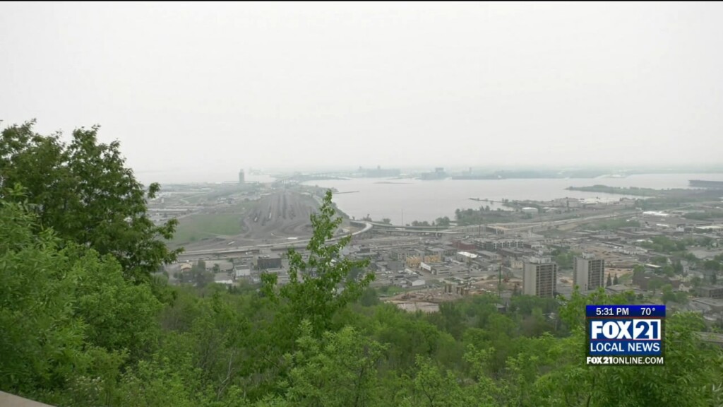
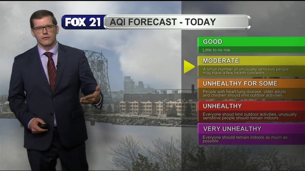
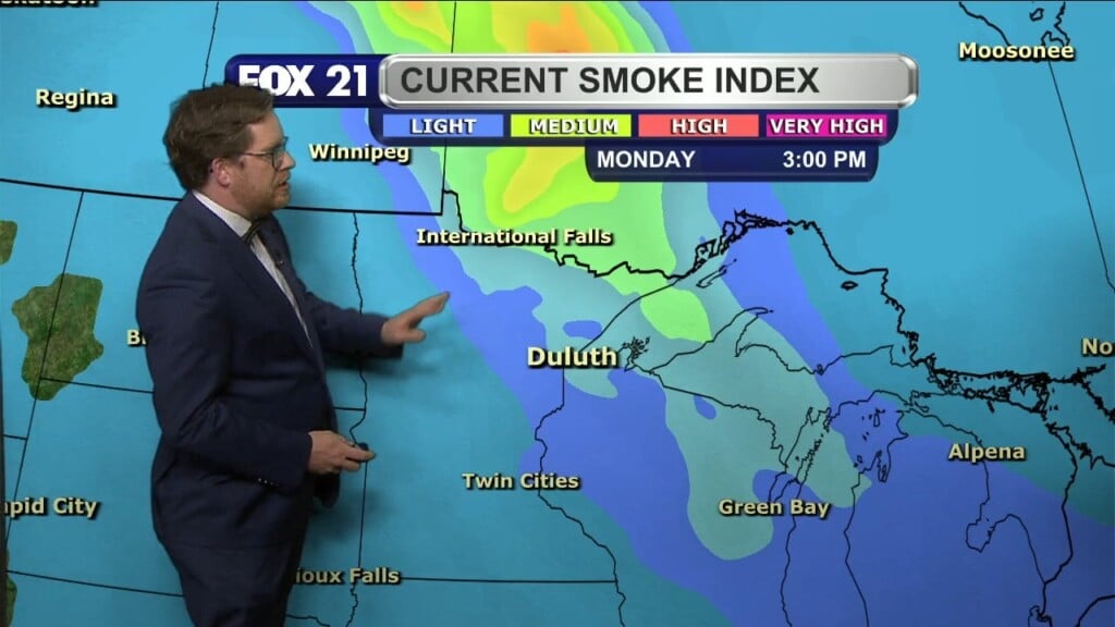
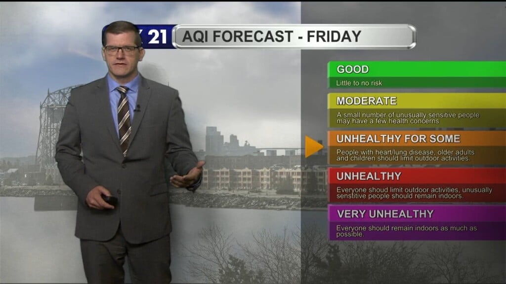
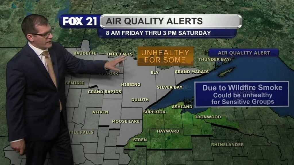
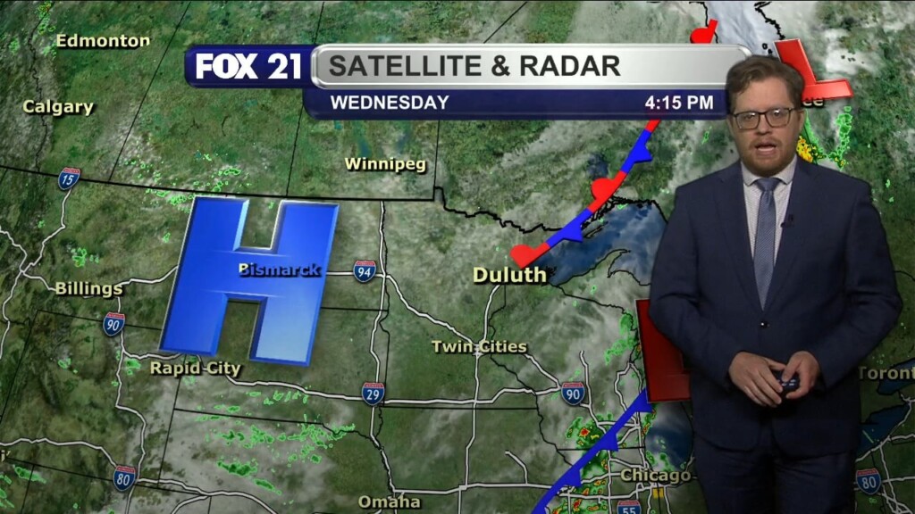
MINNESOTA–It continues to be hazy in the Northland from wildfire smoke from Canada. It’s not going away too quickly as the Minnesota Pollution Control Agency (MPCA) has extended their air quality alert until Tuesday afternoon. Medical professionals from St. Luke’s warned how children, teenagers in athletics, people with asthma, chronic obstructive pulmonary disease (COPD), emphysema, and other heart or lung…
Categories: Weather Blog, Weather Video
Categories: Weather Blog, Weather Video
Categories: Weather Blog, Weather Video
Categories: Weather Blog, Weather Video
Categories: Weather Blog, Weather Video
Categories: Weather Blog, Weather Video
Categories: Weather Blog, Weather Video
Categories: Weather Blog, Weather Video
Categories: Weather Blog, Weather Video
Categories: Weather Blog, Weather Video
Categories: Weather Blog, Weather Video
Categories: Weather Blog, Weather Video
Categories: Weather Blog, Weather Video
Categories: Weather Blog, Weather Video
Categories: Weather Blog, Weather Video
Categories: Weather Blog, Weather Video
Categories: Weather Blog, Weather Video
Categories: Weather Blog, Weather Video
Categories: Weather Blog, Weather Video
Categories: Weather Blog, Weather Video
Categories: Weather Blog, Weather Video
Categories: Weather Blog, Weather Video
Categories: Weather Blog, Weather Video
Categories: Weather Blog, Weather Video
Categories: Weather Blog, Weather Video
Categories: Weather Blog, Weather Video
Categories: Weather Blog, Weather Video
Categories: Weather Blog, Weather Video
Categories: Weather Blog, Weather Video


