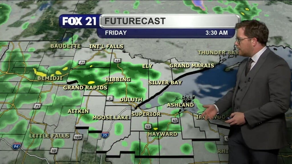
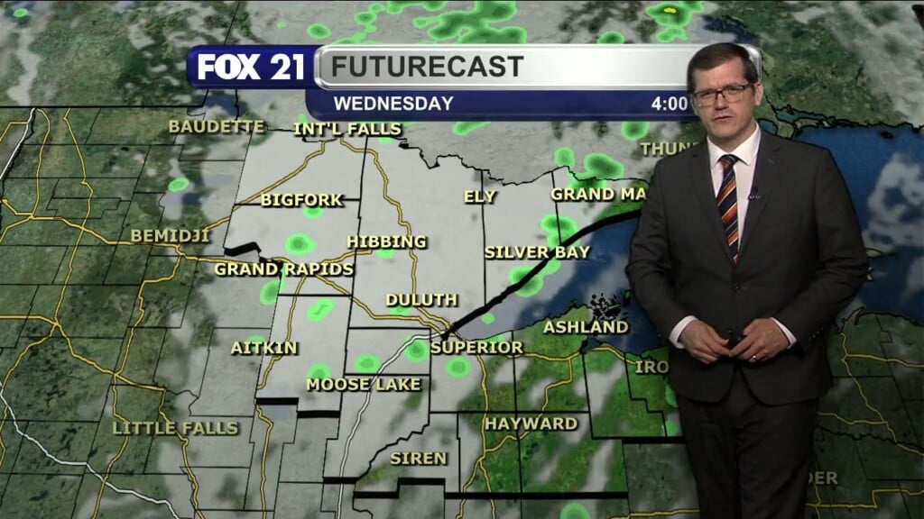
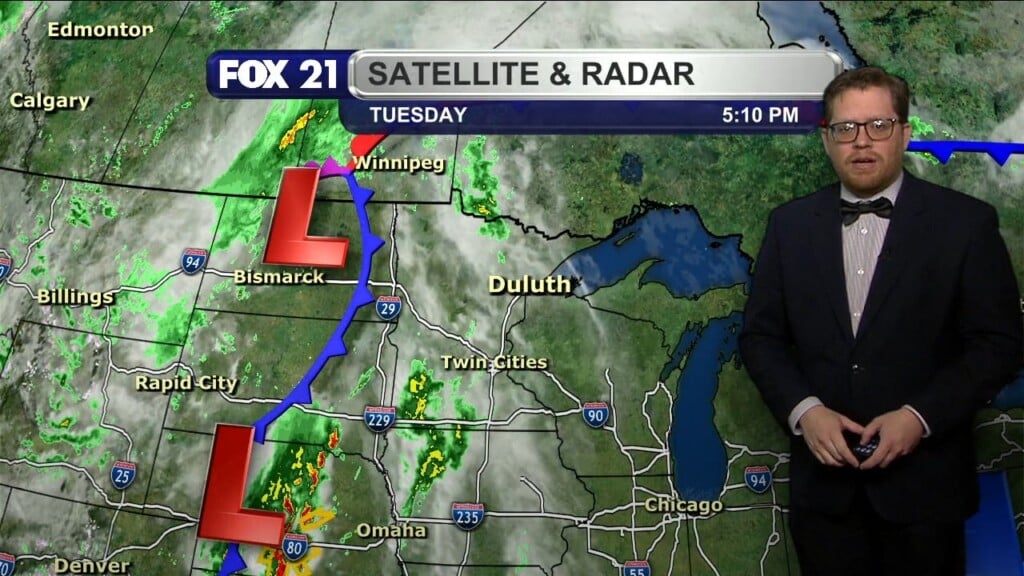
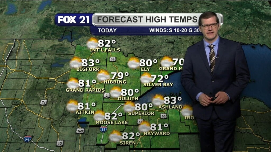
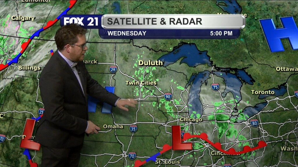
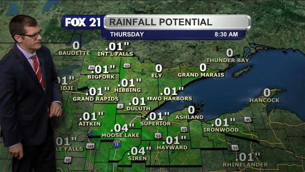
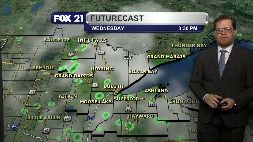
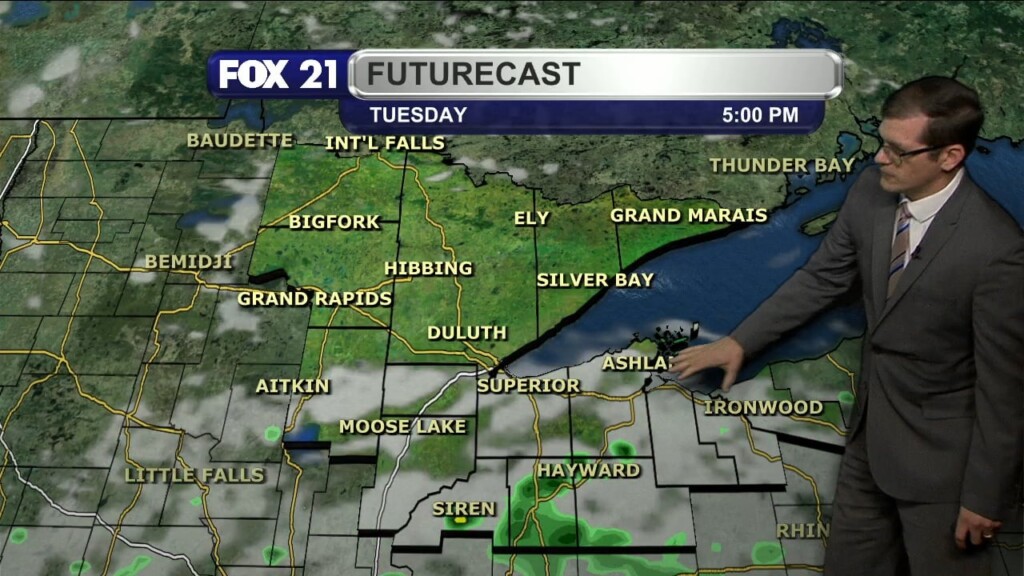
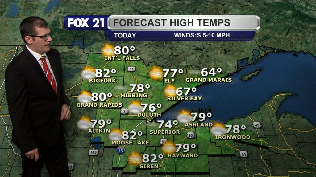
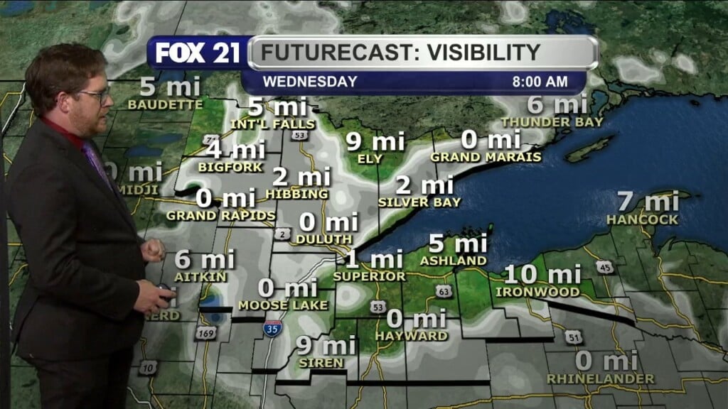
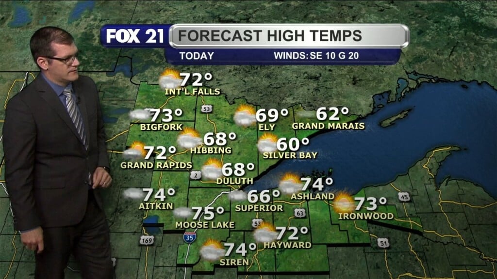
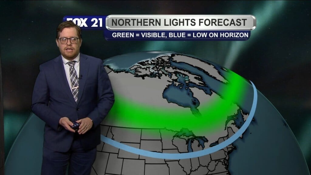
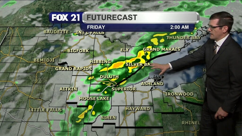
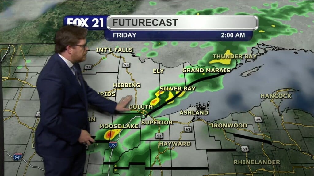
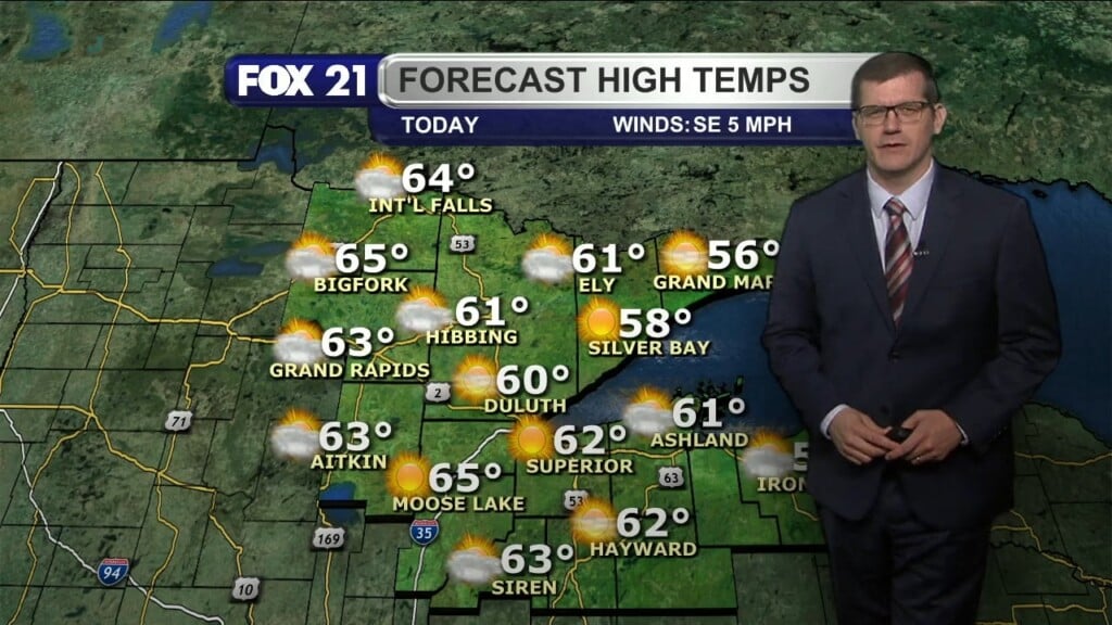
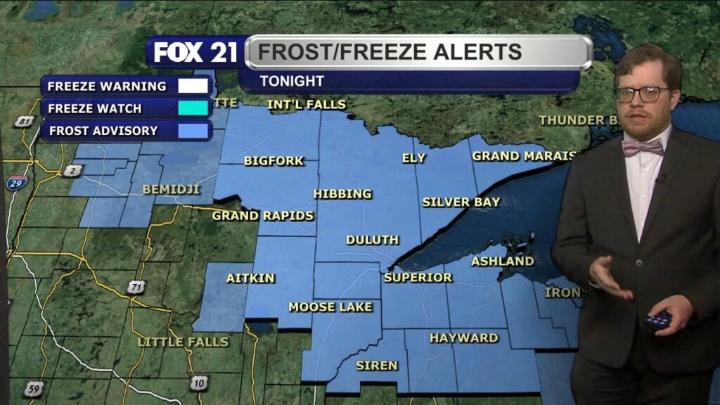
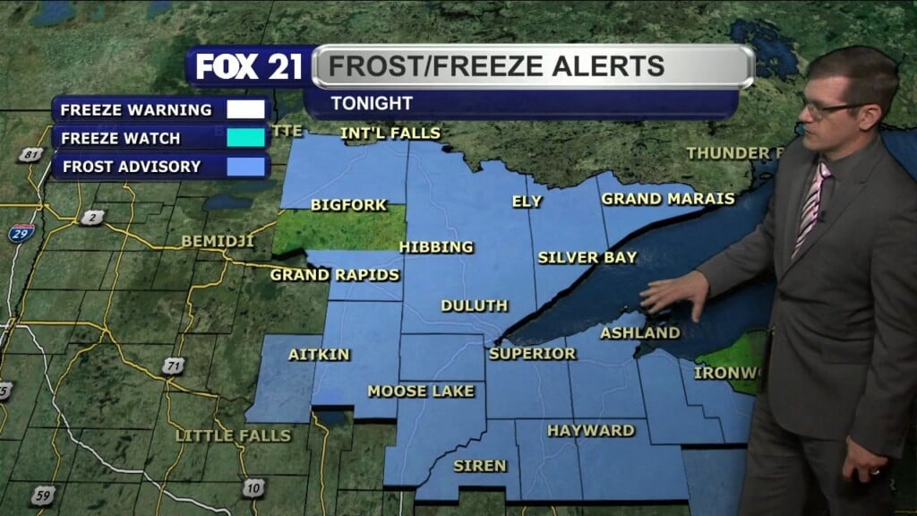
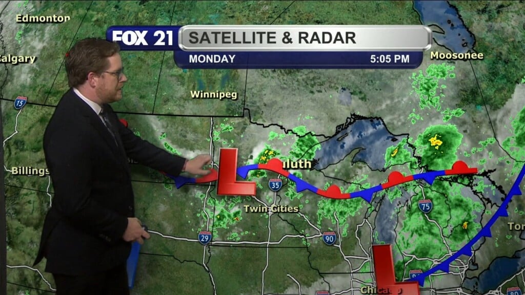
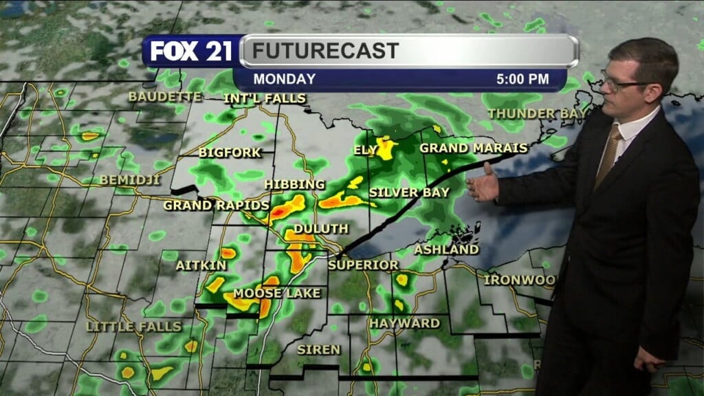
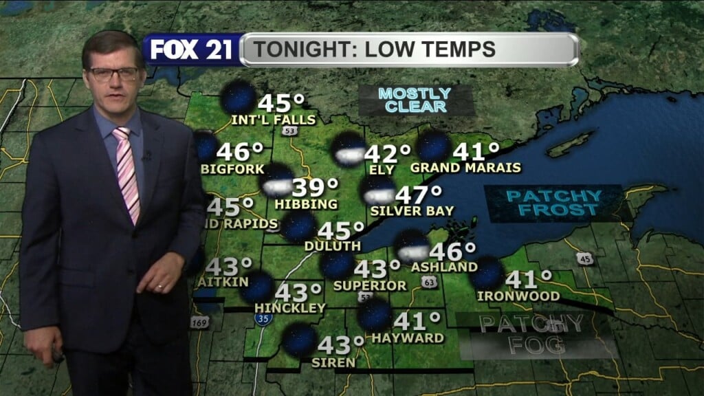
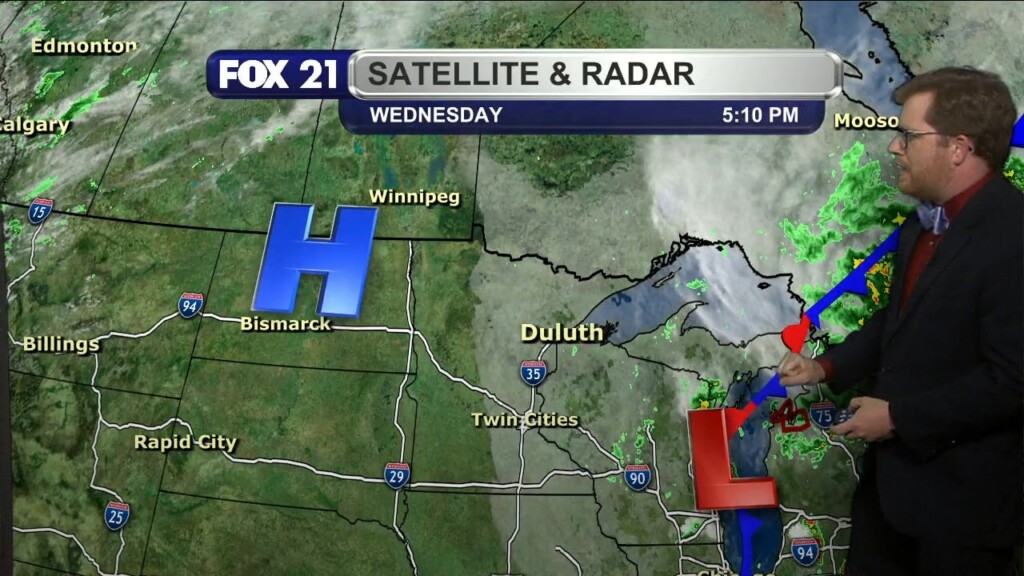
Wednesday Evening Northland Forecast 10/4/2023
Categories: Weather Blog, Weather Video
Categories: Weather Blog, Weather Video
Categories: Weather Blog, Weather Video
Categories: Weather Blog, Weather Video
Categories: Weather Blog, Weather Video
Categories: Weather Blog, Weather Video
Categories: Weather Blog, Weather Video
Categories: Weather Blog, Weather Video
Categories: Weather Blog, Weather Video
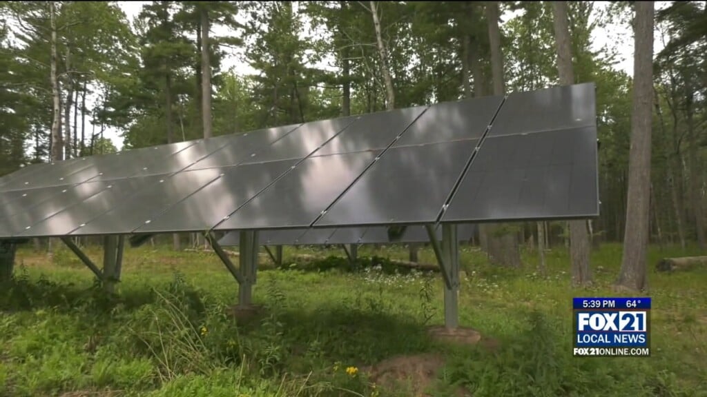
DULUTH, Minn. — In recent years, solar panels have increased in popularity as an alternative energy source for homes, businesses and power companies here in the Northland. However, as we try to capture energy that is produced in nature, the weather itself can cause the greatest setbacks. This past summer, there were reports across the country of solar panels being…
Categories: Weather Blog, Weather Video
Categories: Weather Blog, Weather Video
Categories: Weather Blog, Weather Video
Categories: Weather Blog, Weather Video
Categories: Weather Blog, Weather Video
Categories: Weather Blog, Weather Video
Categories: Weather Blog, Weather Video

DULUTH, Minn. – The staff at Grandma’s Restaurant up by the Miller Hill Mall spent the day mopping up Monday after flood waters moved inside Sunday. Water surrounds the restaurant along Mall Drive Sunday. Tony Boen, the restaurant’s director of operations, said the staff started getting chairs and other items off the floor Sunday morning when they saw the water…
Categories: Weather Blog, Weather Video
Categories: Weather Blog, Weather Video
Categories: Weather Blog, Weather Video
Categories: Weather Blog, Weather Video
Categories: Weather Blog, Weather Video
Categories: Weather Blog, Weather Video
Categories: Weather Blog, Weather Video
Categories: Weather Blog, Weather Video
Categories: Weather Blog, Weather Video
Categories: Weather Blog, Weather Video
Categories: Weather Blog, Weather Video
Categories: Weather Blog, Weather Video
Categories: Weather Blog, Weather Video
Categories: Weather Blog, Weather Video
Categories: Weather Blog, Weather Video
Categories: Weather Blog, Weather Video
Categories: Weather Blog, Weather Video
Categories: Weather Blog, Weather Video
Categories: Weather Blog, Weather Video
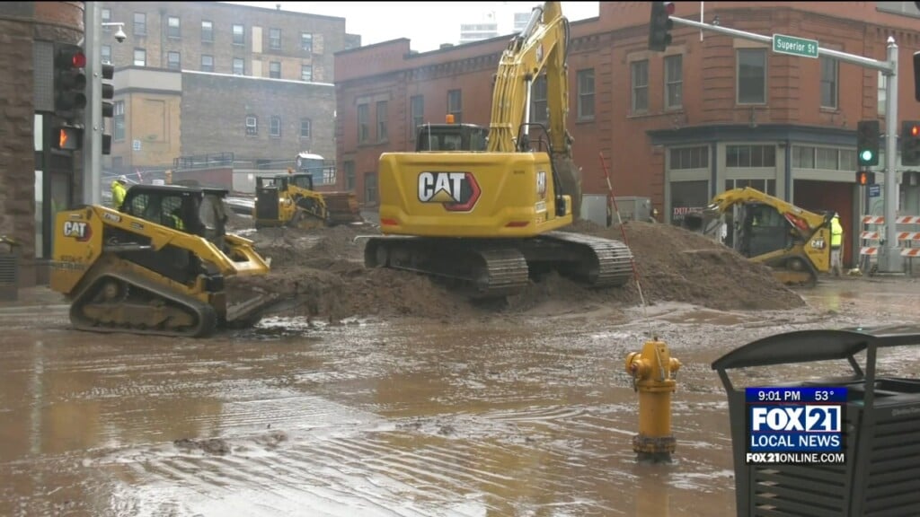
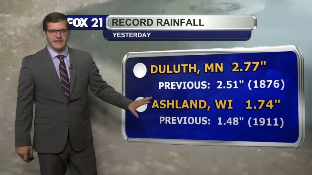
DULUTH, Minn. – Flash flooding Monday night in parts of Duluth sent piles of sand, dirt and other materials from nearby construction onto East Superior Street. Tuesday morning compared to Tuesday evening at First Avenue E. and Superior Street The National Weather Service said 2 to 6 inches of rain fell fast on parts of Duluth. All that water sent…
Categories: Weather Blog, Weather Video
Categories: Weather Blog, Weather Video

DULUTH, Minn. – A heavy downpour of rain over parts of Duluth late Monday evening led to flash flooding, impacting I-35 and other roadways in the Minnesota side of the Twin Ports. The National Weather Service issued a Flash Flood Warning for the northern half of Duluth just before 10 p.m. Monday, September 11, 2023. It was to run until…
Categories: Weather Blog, Weather Video
Categories: Weather Blog, Weather Video
Categories: Weather Blog, Weather Video
Categories: Weather Blog, Weather Video
Categories: Weather Blog, Weather Video
Categories: Weather Blog, Weather Video
Categories: Weather Blog, Weather Video
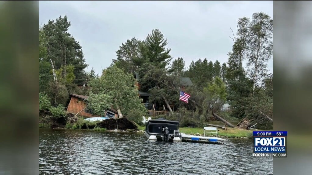
BASS LAKE, Minn. — Wild weather Tuesday evening on the Iron Range created damaging winds that hit the Gilbert, Aurora and Hoyt Lakes region. Courtesy: Alicia Schroeder Powerlines came down, along with hundreds of trees, especially on Bass Lake – just southeast of Gilbert. The National Weather Service does not believe a tornado caused the damage. They believe it was…
Categories: Weather Blog, Weather Video
Categories: Weather Blog, Weather Video


